The Lunar AOD Intercomparison Campaign, carried out in Ny-Ålesund in February 2020, was a collaboration between AWI, CNR, NOAA and others. As part of the access programme SIOS provided travel support for two members of the project team, Robert Stone and John Barnes. They have provided the following report from the campaign.
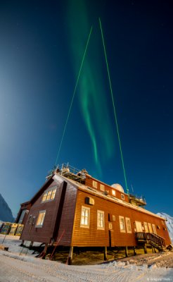
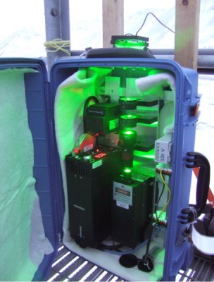
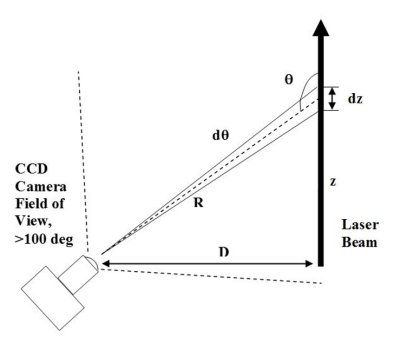
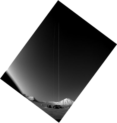
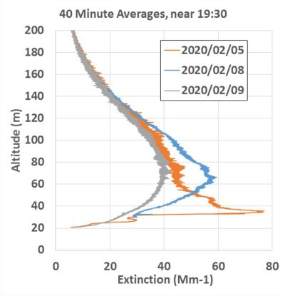
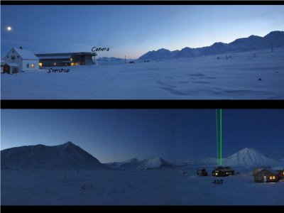
Lidars (laser radars) are valuable tools for measuring aerosols (particles) in the air. But they require pulsed lasers, very fast data-acquisition electronics and have trouble measuring particles near the ground. A very simple and novel technique, called Camera Lidar or CLidar, can measure aerosols by imaging a laser beam from the ground to the zenith with a CCD camera and wide-angle lens. The technique CLidar complements the other lunar and star photometer measurements of Aerosol Optical Depth (AOD) by showing the altitudes of aerosols that make up the AOD. The image is then analyzed pixel by pixel. Brighter parts of the beam indicate more aerosols. The camera at Ny-Ålesund is installed in 150 meters distance from the lasers on top of the Sverdrup building. It records an image every 2 minutes of the two laser beams. One laser is temporarily installed for the campaign on the AWI building, and the other was the AWI lidar laser beam (KARL).
Initial results showed that very often there are more aerosols around 60 meters altitude than there are near the ground. This was unexpected, but might be explained by cold, cleaner air flowing down the glacier and displacing the air at the ground level. The AWI lidar has operated for many years at Ny-Ålesund, but like other standard lidars, is unable to measure at these very low altitudes, so the CLidar provided a nice addition to the lidar results.