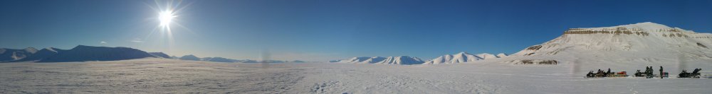
The SIOS-funded project Snow Observation in Svalbard (SOS), performed their field work on snow monitoring in north western Spitsbergen in March 2018. They travelled 1200 km on snowmobiles in order to fulfil their ambitious measuring program.
Snow is a particularly useful climate indicator, as it interacts with all Arctic climate systems and is sensitive to change. The last major snow monitoring effort for central-west Svalbard was carried out in 1997, and given the observable changes in Arctic climate, it is critical to update these data. The SOS project aims to provide an update of the existing data sets for Svalbard by repeating the 1997 transect in addition to mapping previously uncharacterized glaciers. SOS is funded by SIOS as part of the SIOS access pilot call in October 2017.
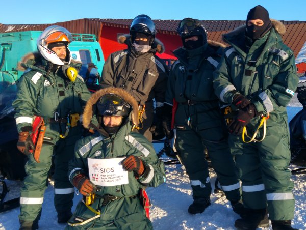
Last month a group of young researchers consisting of Jean Charles Gallet (Norwegian Polar Institute, Tromsø, Norway), Mats Björkman (University of Gothenburg, Sweden), Andrea Spolaor (National Research Council of Italy, Italy), Bartek Luks (Institute for Geophysics, Polish Academy of Science, Poland), Chris Borstad (University Centre in Svalbard, Norway), Christian Zoelly (Norwegian Polar Institute, Norway) and Catherine Larose (National Center for Scientific Research, France) set out to collect the data.
The following is an excerpt from their field blog.
Travel to Ny-Ålesund
Before heading out on the 1200 km trip, we needed to be prepared. After one week of unpacking and packing again, planning, and taking safety courses, we were ready to leave on 21st of March 2018. The first stretch of our trip was from Longyearbyen to the abandoned mining town Pyramiden, with a stay at a lovely hotel with good food and local beverages. The trip went smoothly, despite being a little breezy on the top of Lomonosovfonna (-40°C with wind chill), and lots of hard packed snow that made the driving slow. After arriving in Pyramiden and preparing the snowmobiles for the next day’s travels, we found out from some female Russian tourists that glaciology is the most romantic field of science, but we are not entirely convinced.
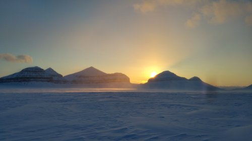
The trip from Pyramiden to Ny-Ålesund was longer and more demanding. We started off with great weather and a beautiful spot for lunch in Dicksendalen. Although we thought we were almost home, there were still some routes to open, especially to get to Uversbreen. We were happy to reach Brøgger peninsula and even more so to finally get to Ny-Ålesund where we were welcomed after 11 hours of driving by locals -and food.
Field work in and around Ny-Ålesund
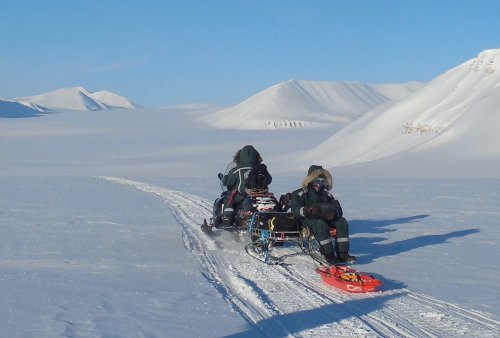
After packing and unpacking and a nice rest in the settlement of Ny Ålesund, we were able to take our route back out onto Holtedahlfonna, a 45 km long glacier located North-East of Ny-Ålesund, to start our scientific measurements. One of our goals is to use a radar to estimate snow depth along the central line of different glaciers around Svalbard and calibrate them with snow pit measurements. Bartek strapped on the radar and JC drove him up to the top of the glacier at a speed of 15 km an hour, while Andrea and Catherine dug snow pits for density measurements and stratigraphy. Another goal of the project is to improve collaboration among research infrastructures and stations of the Svalbard Integrated Arctic Earth Observing System (SIOS). Therefore it was important for Bartek, who runs the snow monitoring program at the Polish Polar Station Hornsund, to see how the measurements are being done in Ny-Ålesund.
Coming back to Longyearbyen
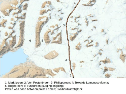
After a long drive in white out conditions and sea ice passages from Ny-Ålesund to Pyramiden, we needed a good rest before starting our measurements. We initially planned to radar and sample the snow pack at Lomonosovfonna, but the snow conditions were too poor to obtain reliable data there. Instead, we decided to go for Philippbreen and Marittbreen, two glaciers located in a very dynamic glacier basin. Both of these glaciers are used regularly to travel around in Svalbard and our measurements there will provide new data on the state of the route through Svalbard. The day went well, with clear and cold conditions, and we were able to dig the snow pits in exceptionally hard wind packed snow. After a long ride we safely reached Longyearbyen.
Going southbound
Although we had originally planned to drive to Hornsund, we had to alter these plans for safety issues related to sea-ice and glacier conditions. Instead, we still headed south, but towards Sveagruva and some of the mines in the region. On the way, we measured Slakbreen and redid the transect as published by J.G. Winther et al. in 1997. The aim was to see how snow accumulation patterns have changed.
Overall, SOS was a success, for several reasons: (1) we got back without breaking anything and without any injuries, (2) from a scientific point of view, our data will provide information on the state of a wide range of glaciers from different regions and with different altitudes and accumulation patterns, and (3) from a logistics point of view, we showed that we were able to plan and carry out scientific transects in Svalbard. The opening of new routes will help us establish feasible new monitoring sites that are logistically accessible and develop new programs in the future.