InfraNOR

COAT_Exclosure_2

Contact
Åshild Ø. Pedersen
Ashild.Pedersen@npolar.no
Info
land platform (fixed)
Operational
Observation Facility ID
10771
Geospatial location
POINT (11.69355 78.95907)
0.00
Environment
Papphytta; Terrestric exclosure with fence. Old exclosure, which has been renovated in 2019.
Observed Variable(s)
BIOSPHERE>VEGETATION>BIOMASS
seasonal

COAT_Exclosure_1

Contact
Åshild Ø. Pedersen
Ashild.Pedersen@npolar.no
Info
land platform (fixed)
Operational
Observation Facility ID
10771
Geospatial location
POINT (11.84997 78.9328)
0.00
Environment
Kolhamnlaguna; Terrestric exclosure with fence. Old exclosure, which has been renovated in 2019.
Observed Variable(s)
BIOSPHERE>VEGETATION>BIOMASS
seasonal

COAT_Temperature logger_4

Contact
Åshild Ø. Pedersen
Ashild.Pedersen@npolar.no
Info
land platform (fixed)
Operational
Observation Facility ID
5974
Geospatial location
POINT (11.72397508 78.79850244)
0.00
Environment
24 loggers on Sarsøyra
Observed Variable(s)
ATMOSPHERE>ATMOSPHERIC TEMPERATURE>SURFACE TEMPERATURE
Annual (logger changed in summer)

COAT_Temperature logger_3

Contact
Åshild Ø. Pedersen
Ashild.Pedersen@npolar.no
Info
land platform (fixed)
Operational
Observation Facility ID
5974
Geospatial location
POINT (11.9194402 78.91659279)
0.00
Environment
40 loggers on Brøgger Peninsula.
Observed Variable(s)
ATMOSPHERE>ATMOSPHERIC TEMPERATURE>SURFACE TEMPERATURE
Annual (logger changed in summer)

COAT_Temperature logger_2

Contact
Åshild Ø. Pedersen
Ashild.Pedersen@npolar.no
Info
land platform (fixed)
Operational
Observation Facility ID
5974
Geospatial location
POINT (11.82742935 78.85451296)
0.00
Environment
40 loggers on Brøgger Peninsula.
Observed Variable(s)
ATMOSPHERE>ATMOSPHERIC TEMPERATURE>SURFACE TEMPERATURE
Annual (logger changed in summer)

COAT_Temperature logger_1

Contact
Åshild Ø. Pedersen
Ashild.Pedersen@npolar.no
Info
land platform (fixed)
Operational
Observation Facility ID
5974
Geospatial location
POINT (11.74502211 78.94862724)
0.00
Environment
40 loggers on Brøgger Peninsula
Observed Variable(s)
ATMOSPHERE>ATMOSPHERIC TEMPERATURE>SURFACE TEMPERATURE
Annual (logger changed in summer)

Kongsfjorden Rijpfjorden Observatory Programme (KROP) - Kongsfjorden Observatory

Contact
Daniel Vogedes
daniel.vogedes@uit.no
Info
sea platform (fixed)
Operational
Yes
Observation Facility ID
11107
11106
Geospatial location
POINT (11.82048 78.959905)
-20.00
Environment
Observatory moored with anchor weight. Bottom depth around 220 m. About 200 m of mooring line. Subsurface buoyancy at about 20 m water depth (hence the -20 m above sea level which refers to the start of the mooring line, not an actual instrument depth). Top 20 m left empty due to risk of ice scouring. Main "photo" is an example of a mooring diagram. Mooring setup is similar for other years, but does have changes in the details. Additional photos to illustrate some of the instrumentation.
Data is available at https://archive.sigma2.no/ split up according to years and sensor types.
Observed Variable(s)
OCEANS>SALINITY/DENSITY>CONDUCTIVITY
Various SeaBird SBE16/19p and SBE37
Instrument turnaround once a year. In most years, instruments will be sent to SeaBird for calibration. Often intercalibration with shipboard CTD.
Sampling intervals vary between 12 minutes (SBE56) and 4 hours (SBE16/19p).
OCEANS>OCEAN TEMPERATURE>WATER TEMPERATURE
Various instruments since 2006. Mostly SeaBird SBE16/19p, SBE56, SBE37. During the first years Vemco microloggers were used instead of SBE56.
Instrument turnaround once a year. In most years, instruments will be sent to SeaBird for calibration. Often intercalibration with shipboard CTD.
Sampling intervals vary between 12 minutes (SBE56) and 4 hours (SBE16/19p).
OCEANS>MARINE SEDIMENTS>SEDIMENTATION
McLane Mark 78H-21 Sediment trap 21-way on non-regular schedule (higher rate during peak sedimentation time).
No specific maintenance, annual recovery, service and redeployment.
500 ml bottles. Samples on 4% Formalin (mostly buffered with Borax, occasionally Hexamin, since 2023: no buffer)
Standard sampling schedule:
1 16/09/2022
2 01/10/2022
3 01/11/2022
4 01/12/2022
5 01/01/2023
6 01/02/2023
7 01/03/2023
8 15/03/2023
9 29/03/2023
10 12/04/2023
11 26/04/2023
12 10/05/2023
13 24/05/2023
14 07/06/2023
15 21/06/2023
16 28/06/2023
17 05/07/2023
18 12/07/2023
19 19/07/2023
20 26/07/2023
21 09/08/2023
22 23/08/2023 (open)
OCEANS>OCEAN ACOUSTICS>ACOUSTIC SCATTERING
RDI Workhorse 300 kHz ADCP various s/n
no specific maintenance, annual battery replacement and data recovery
Deployed at 100 m, one upward and one downward facing. 20 min ensemble interval, 1 min ping interval, 20 pings / ensemble, 30 depth cells, 4 m depth cell size
OCEANS>SALINITY/DENSITY>SALINITY
Various SeaBird SBE16/19p and SBE37
Instrument turnaround once a year. In most years, instruments will be sent to SeaBird for calibration. Often intercalibration with shipboard CTD.
Sampling interval between 2-4 hours year round. Derived variable from conductivity, temperature and depth.
OCEANS>OCEAN ACOUSTICS>AMBIENT NOISE
Multi-Electronique AURAL M2/M3 various s/n
No specific maintenance
Hydrophone recording varied over the years. Mostly 10 min recording / hour but several years with power issues and incomplete recordings
OCEANS>OCEAN OPTICS>TURBIDITY
Seapoint turbidity sensor
Occasional calibration
Sampling interval 4 hours. Only deployed a few years.
Additional photos

Bayelva station

Contact
Harald Songe
haso@nve.no
Info
lake/river platform (fixed)
Operational
Yes
Observation Facility ID
1668
11353
Geospatial location
POINT (11.835 78.9325)
12.00
Environment
Bayelva is situated on Brøggerhalvøya, due west of Ny-Ålesund. The catchment area is 30.9 km² of which 54 % is covered by the glaciers Austre Brøggerbreen and Vestre Brøggerbreen. In 1988 NVE initiated the discharge measurements and the river profile of Bayelva was stabilised by a large compound crump weir, designed and built by NVE. The cost was about 1 million Norwegian 1988-kroner. As the river profile is constantly changing there followed several problems, mainly due to the large amounts of sediment and ice build-up, but most were solved the following year.
The main problems with the runoff measurements are connected to ice and snow blocking the weir at the beginning of the snowmelt season (Fig. 14), leading to errors in calculation of river discharge. This is corrected for as far as possible, but the resulting accuracy is not known precisely.
Observed Variable(s)
TERRESTRIAL HYDROSPHERE>SURFACE WATER>SURFACE WATER PROCESSES/MEASUREMENTS>RUNOFF
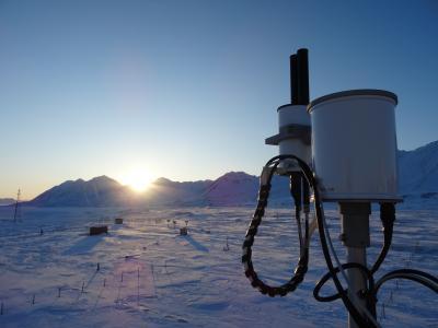
Sutron IridiumLink logger 9602, type, 1311454 serial number
Pressure Level sensor WIKA 891, type, 3367862 serial number
? Pressure Level sensor 4 TECH MT-30, 21160 type, 0104189 serial number
Yearly maintenance by NVE, short inspection by NP. Discharge measurements carried out on different water level/stages in order to convert from water stages to discharge/runoff.
Sampling water stage at hourly intervals using both radar sensor and pressure transducer during the summer season. Now water in the river during late autumn winter and spring.
ATMOSPHERE>ATMOSPHERIC TEMPERATURE>SURFACE TEMPERATURE>AIR TEMPERATURE
Sutron Iridiumlink logger 9602 type, 1311454 serial number
Air temperature using pt100, 10040 type, ? serial number.
Young radiation screen
Yearly maintenance by NVE during summer season.
Temperature measurements are made using an pt100 element protected in Young radiation screen and reported hour data.
TERRESTRIAL HYDROSPHERE>WATER QUALITY/WATER CHEMISTRY>WATER CHARACTERISTICS>WATER TEMPERATURE
Water temperature measured using Vemco Minilog-II-T
Yearly exchange of logger by NVE. Data not online
Water temperature measurements are made using a Vemco Minilog-II-T one sample each hour, during the summer season. Now water in the river during late autumn winter and spring.
TERRESTRIAL HYDROSPHERE>WATER QUALITY/WATER CHEMISTRY>WATER CHARACTERISTICS>CONDUCTIVITY
ISCO water sampler, 600 type, 203D01323 serial number
Yearly maintenance by NVE, short inspection by NP and maintenance of the sediment sampler during the summer season.
Conductivity measured in water samples taken at 8 hourly intervals during the summer season. Now water in the river during late autumn winter and spring.
TERRESTRIAL HYDROSPHERE>WATER QUALITY/WATER CHEMISTRY>SOLIDS>SUSPENDED SOLIDS
ISCO water sampler, 600 type, 195-H01890 serial number
Yearly maintenance by NVE, short inspection by NP and maintenance of the sediment sampler during the summer season.
Sediment concentration measured in water samples taken at 8 hourly intervals during the summer season. Now water in the river during late autumn winter and spring.
TERRESTRIAL HYDROSPHERE>WATER QUALITY/WATER CHEMISTRY>WATER CHARACTERISTICS>ORGANIC MATTER
ISCO water sampler, 600 type, 195-H01890 serial number


Yearly maintenance by NVE, short inspection by NP and maintenance of the sediment sampler during the summer season.
Organic matter concentration measured in water samples taken at 24 hourly intervals during the summer season. Now water in the river during late autumn winter and spring.

Linnévatnet hydrological station

Contact
Kjetil Melvold
kjme@nve.no
Info
lake/river platform (fixed)
Operational
No
Observation Facility ID
1668
11353
Geospatial location
POINT (13.777225 78.067139)
10.00
Environment
The catchment area is 27 km² of which 6.3% is glacier covered. The monitoring station will be placed in the river just downstream of the lake in stable sediment and rock profile.
Observed Variable(s)
TERRESTRIAL HYDROSPHERE>SURFACE WATER>SURFACE WATER PROCESSES/MEASUREMENTS>DISCHARGE/FLOW
TERRESTRIAL HYDROSPHERE>WATER QUALITY/WATER CHEMISTRY>WATER CHARACTERISTICS>WATER TEMPERATURE
TERRESTRIAL HYDROSPHERE>WATER QUALITY/WATER CHEMISTRY>SOLIDS>SUSPENDED SOLIDS
ATMOSPHERE>ATMOSPHERIC TEMPERATURE>SURFACE TEMPERATURE>AIR TEMPERATURE

Pandora, Sverdrup Station, Ny-Ålesund

Contact
Ann Mari Fjæraa
ann.mari.fjaeraa@nilu.no
Info
land platform (fixed)
Operational
No
Observation Facility ID
10137
Geospatial location
POINT (11.93007 78.92346)
10.00
Observed Variable(s)
ATMOSPHERE>ATMOSPHERIC CHEMISTRY>NITROGEN COMPOUNDS>CLOUD-SCREENED TOTAL COLUMN NITROGEN DIOXIDE (NO2)