Radar Monitoring of Calving at Hansbreen (RaMoCH)
by William Harcourt, University of St Andrews
Our project, Radar Monitoring of Calving at Hansbreen (RaMoCH), successfully completed its first field season in the summer of 2021. We navigated the complicated world of international travel during the COVID-19 pandemic, which included numerous COVID-19 tests and a lengthy stay in hotel quarantine. We travelled to Svalbard on 22nd July 2021 and reached the Polish Polar Research Station in Hornsund a few days later and we would like to thank everyone associated with the station for their help throughout the project.
Our core aim was to quantify how much ice is currently being released into the ocean at the Hansbreen glacier terminus, which is known as the calving rate. We measured this process using a unique millimetre-wave radar sensor (called AVTIS2) that mapped the geometry and radar reflectivity of the Hansbreen ice front over 8 days. This was the first time millimetre-wave radar had ever been used to map a glacier calving front. We also monitored glacier calving activity using a Terrestrial Laser Scanner (TLS), a time-lapse camera and a seismic network. Additionally, we investigated recent retreat of the glacier by analysing the proglacial geomorphology.
Combining these measurements together will provide a detailed account of processes underpinning glacier retreat at Hansbreen and address the pressing requirement for high resolution observations of glacier calving activity. Members of the Svalbard science community will be able to use these data sets to improve our understanding of how glaciers in Svalbard are responding to climate warming. Finally, we have developed a new sensor for monitoring glacier calving fronts which can now be used in future studies of glacier dynamics.
The RaMoCH team (RiS ID: 11446) would like to sincerely thank SIOS for funding this project and for their incredible support throughout, especially in these very difficult times.
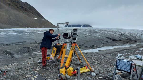
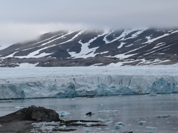
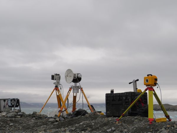
Figure Captions
Figure 1: Setting up the field site where we deployed our remote sensing instruments (Image credit: Dannielle Pearce).
Figure 2: View across the Hansbreen ice front. Instruments were deployed on the rock outcrop on the bottom left of the image. (Image credit: Will Harcourt).
Figure 3: The TLS, AVTIS2 millimetre-wave radar and time-lapse camera. (Image credit: Will Harcourt).
Award winning video documentary of the SIOS-funded RaMoCH field campaign
William made a video documentary of the RaMoCH field campaign and submitted it to the ENVRI User Story Competition. The video won the competition and was awarded €3000 towards fieldwork in 2022. Congratulations Will!
